
Every sailor wants the best sailing apps for navigation, weather, and anchoring, but no app can take the helm for you. Your phone can show wind speed, chart a route, and warn you if your anchor drags overnight.
It still can't read the sky the way an experienced skipper does. Below, we'll walk through five apps for weather, routes, and anchor watch, plus where each one comes up short.
What to Look for in a Sailing App
Useful navigation apps cover a few basics, regardless of price or brand, these include:
Detailed nautical charts, official or crowd-sourced
Continuous Global Positioning System (GPS) tracking and route-planning tools
Weather forecasts and tide tables before you leave the dock
Offline access, since cell service disappears fast offshore
Automatic identification system (AIS) integration to spot nearby vessels before they spot you
Many sailors pair these apps with an onboard chart plotter as backup, since apps can crash or drain a phone battery mid-passage.
The Best Sailing Apps for Navigation, Weather, and Anchoring
These five apps for sailing cover the basics of weather, route planning, and anchor watch.
1. Windy – Best for Reading the Weather Before You Sail
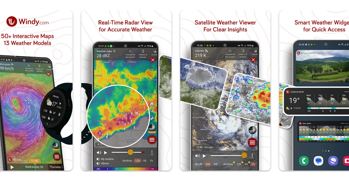
Image source: play.google.com
Windy turns weather forecast data into a map you can read at any spot on the globe. It draws on global models like the European Centre for Medium-Range Weather Forecasts (ECMWF) and the Global Forecast System (GFS), plus more than a dozen local ones.
Key features include:
51 weather maps in one dashboard, covering wind, rain, pressure, and wave height
Satellite and radar overlays that update every five to fifteen minutes
Swell height, wave direction, and tide forecasts for any anchorage
Sunrise, sunset, and time zone details for your exact spot
Custom alerts for your saved locations, free with no ads
Reach for Windy when planning a passage days out, comparing weather models side by side, or squeezing in a quick check before casting off.
The depth of data here is rare for a free weather app. However, a few sailors say the radar has grown less consistent over time. Check wind speeds against a second source before you commit to a route.
2. PredictWind – Best for Route and Departure Planning
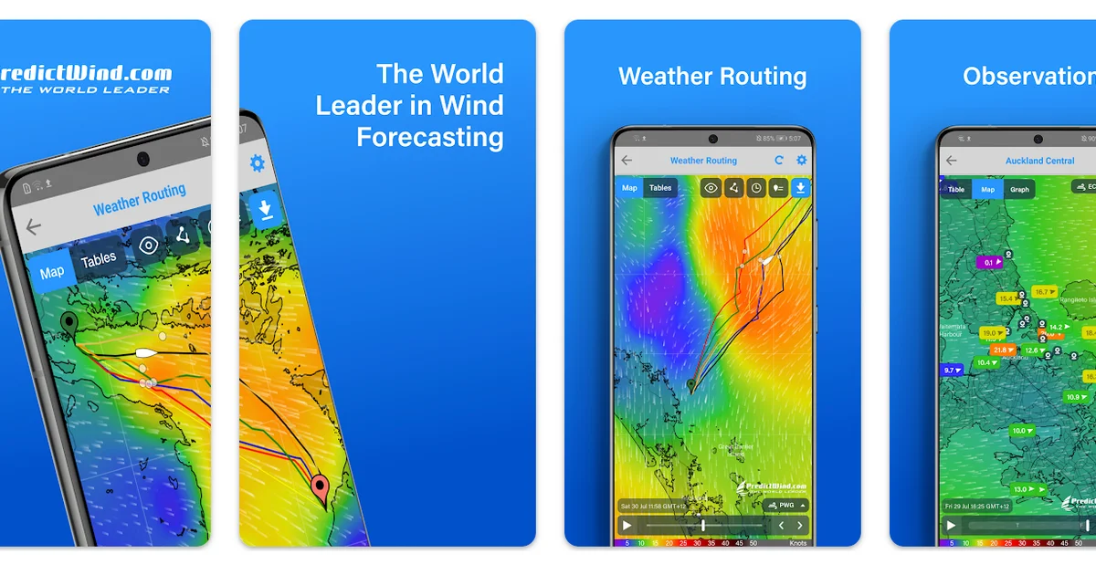
Image source: play.google.com
PredictWind blends public models like ECMWF with its own PWAi, PWG, and PWE models, tuned specifically for ocean sailing, to pick safer routes and departure days, so sailors who cross open water rely on it most.
Key features include:
Weather Routing that maps the fastest or most comfortable course for your boat
Departure Planning that compares the next four days to find your best window
High-resolution wind, wave, tide, and sea temperature maps
Up-to-date wind reports from more than 20,000 stations worldwide
AIS data covering more than 280,000 vessels
A daily briefing plus graphs and tables for deeper analysis
Ocean data covering tides and sea temperature below the waterline
Turn to PredictWind before an offshore passage, when departure timing counts as much as the route. It also factors in your boat's cruising speed in knots for passage planning.
The catch is price, since the full feature set needs a subscription. Some users say that saved tables no longer sync offline as before.
3. Anchor Alarm – Best for Overnight Anchor Watch
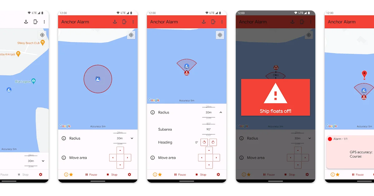
Image source: play.google.com
Anchor Alarm does one job, and it tells you if your boat drifts off its mooring spot while you sleep. Turn it on once, and it keeps watch in the background from there.
Key features include:
An adjustable radius, precise to the meter, that sounds an alert the moment your boat drifts past it
Location history so you can review your swing pattern after a rough night
Remote monitoring that links two phones for anyone checking in from shore
Anchorage search to help you find a solid spot to drop your hook
Anchor Alarm covers planning and monitoring for overnight anchor watch, especially in a crowded bay. You can also pair it with a second phone if your crew splits up.
Users report false alarms often, and some note GPS drift up to twenty meters, so treat it as a backup alongside a visual check on deck.
4. Navily – Best for Finding Safe Anchorages
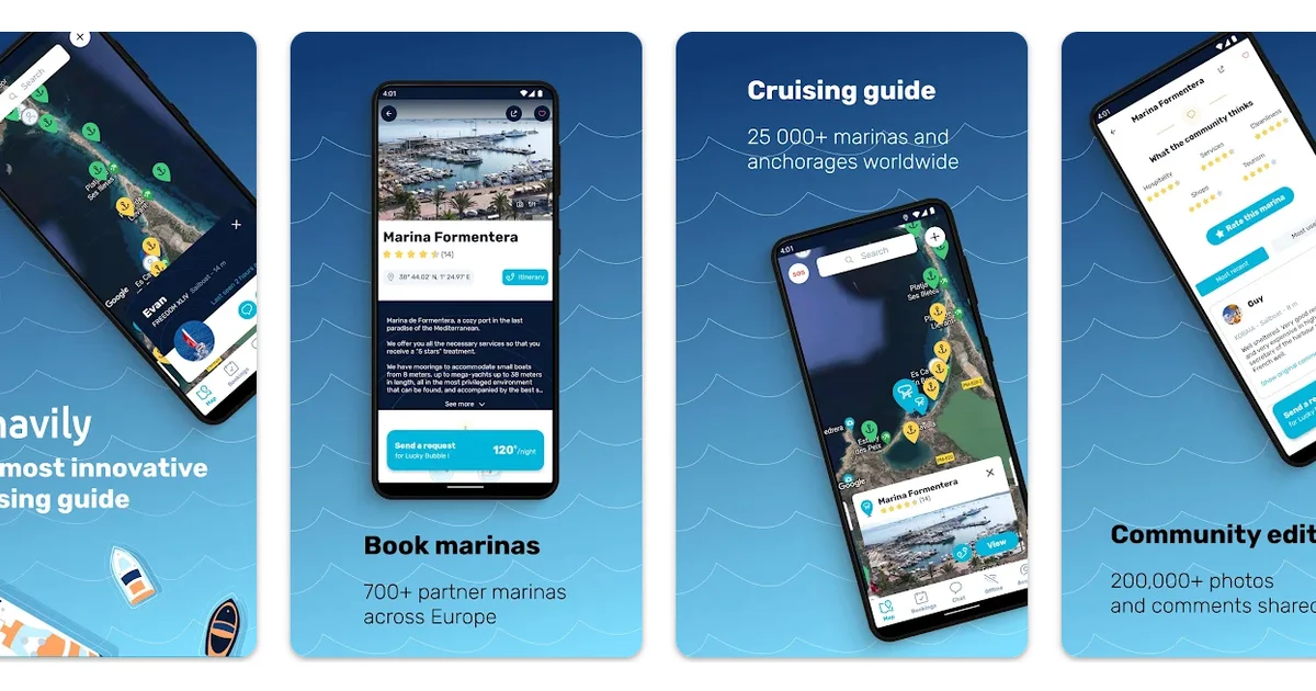
Image source: play.google.com
Navily maps anchorages and marinas in dozens of sailing destinations, with reviews written by boaters who've anchored there before, not a marketing brochure. That makes it easier to plan a route and book a spot for the night before you arrive.
Key features include:
A community of more than 1.2 million boaters worldwide
More than 35,000 marinas and anchorages, with depth and seabed details
Over 500,000 reviews and photos, translated automatically
Direct booking at more than 700 marinas, with berth pricing and VHF channel details
Protection scores that rate wind and swell shelter at anchor
An SOS feature to reach nearby boaters in an emergency
Offline mode for when you're off the grid
Check Navily before arriving at an unfamiliar place for a berth booked in advance. Liveaboard sailors also lean on it for tips on tricky entrances.
Some recent updates have made the app slower and prone to freezing, according to user reports. A few users say it takes longer to load in areas with a weak connection.
5. MarineTraffic – Best for Tracking Nearby Vessels
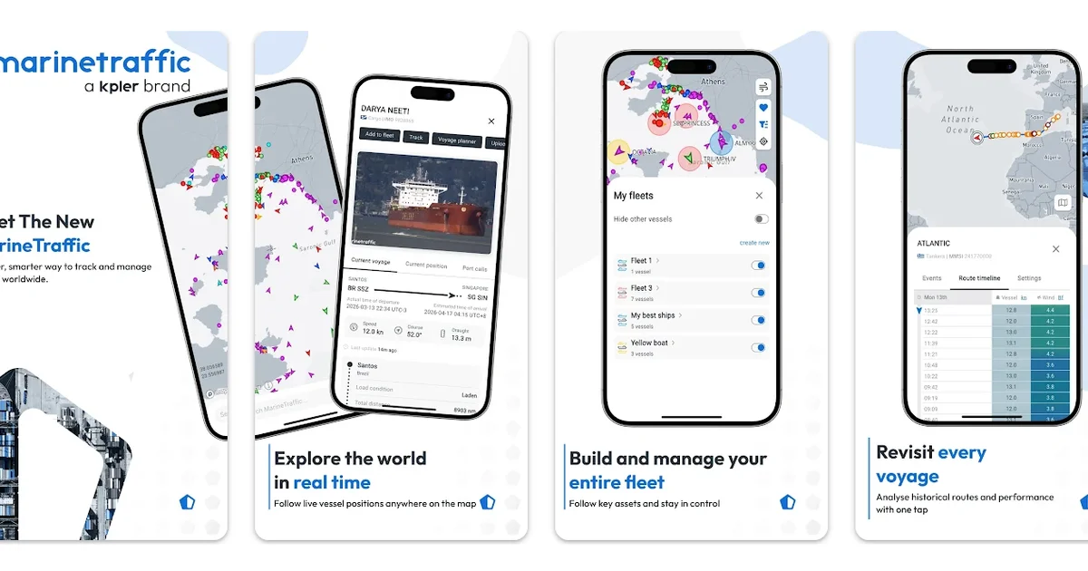
Image source: play.google.com
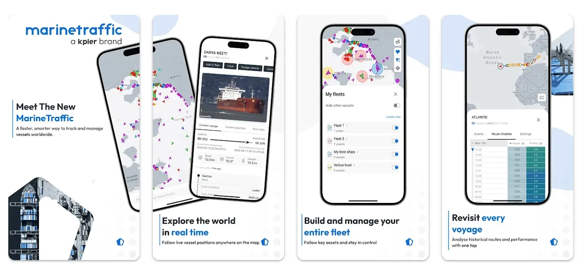
MarineTraffic tracks vessels using one of the largest AIS networks anywhere, combining land, sea, and satellite coverage to spot a ship well offshore, where land-based trackers can't reach.
Recreational sailors rely on that reach to check for ship traffic before crossing a busy lane.
Key features include:
Ongoing tracking for more than 350,000 vessels
Search by ship name, flag, or type
A vessel's GPS position, speed, course, and arrival time, updated as it happens
An augmented reality mode that labels nearby vessels through your camera
Port arrival and departure tracking at more than 21,000 ports
A photo library of ship and lighthouse images
Open MarineTraffic before crossing a shipping lane or entering a busy harbor. It's less useful at a quiet anchorage, since fewer vessels pass through.
Common complaints include wrong position data, with one sailor reporting an error of more than 600 nautical miles. Login errors also lock some users out for days at a time.
What These Apps Can't Teach You
A screen can show you wind speed, but it can't teach you how a boat feels when a gust hits beam-on, since that comes from hours spent sailing.
Sailing Virgins designed its courses around this idea. Students spend seven days living aboard the same sailboat they're learning to sail, so checking the weather, plotting courses, and standing night watches becomes second nature by the end of the week.
Courses run in the most beautiful sailing destinations, each with its own wind patterns and navigation challenges to learn from.
Beginners often earn their first American Sailing Association (ASA) certifications, ASA 101 and 103, together in one week. Sailors with more time move on to ASA 104, 105, 106, or the catamaran-focused ASA 114.
ASA courses turn app knowledge into skills you can use without a phone in hand, so by the end of the week, students read the sky the way these apps read a forecast model.
Ready for Open Water? Book a Sailing Virgins’ Liveaboard Course Today!
The best sailing apps for navigation, weather, and anchoring help you prepare before you leave the dock and adjust once you're underway.
None of the apps in the list replaces what you learn aboard a boat with an instructor. A Sailing Virgins liveaboard course pairs ASA certification with hands-on time at the helm in some of the most stunning locations.